Point Cloud Data and 3D Visualization — A Game Changer for Urban Infrastructure
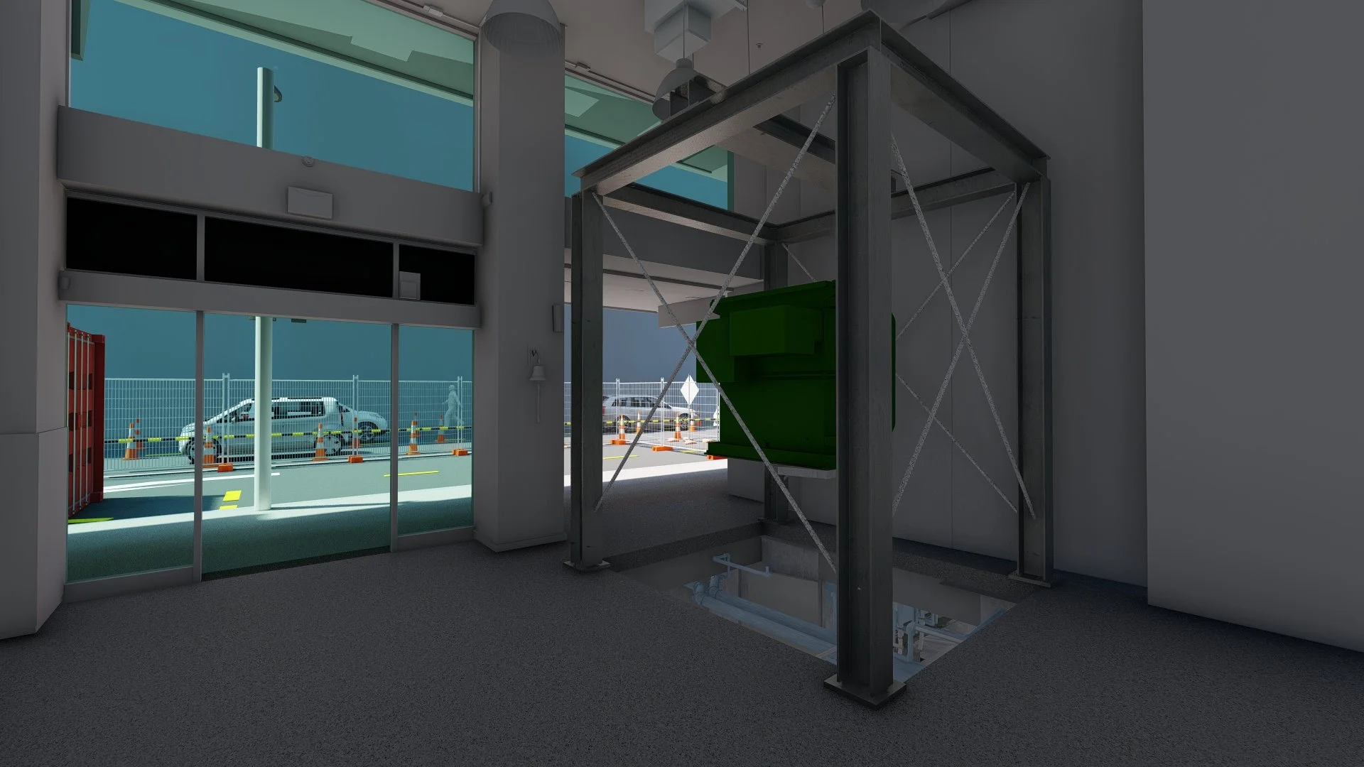
Temporary Works model in place following scan data capture
We recently had the opportunity to work alongside Recon Advanced Spatial Solutions and a specialist electrical contractor on the planning and logistics for a major transformer replacement in Auckland's CBD. It was one of the more technically complex projects we've been involved in and a clear demonstration of why point cloud data and 3D visualization have a strong value add in dense urban high-risk construction environments.
The problem with traditional site information
Dense inner-city environments are unforgiving. The Millimetre matter. Assumptions cost money, and the sources of site information that project teams typically rely on; council aerial imagery, Google Street View, old survey data — are rarely current enough or accurate enough to support the kind of decision-making that complex urban projects demand.
The questions that slow teams down are almost always the same:
Is this aerial imagery actually current or is it two years old?
What do the road markings, kerb lines, and clearances really look like on site today?
How much usable space is there once street furniture, trees, and services are accounted for?
Has the survey captured enough information to support every phase of construction?
These challenges compound when teams are working remotely or across multiple organisations, which in today's project environment is almost always the case.
Point cloud data removes that uncertainty entirely.
A high-quality point cloud scan creates a measurable digital twin of the site as it exists at a specific point in time.
Think of it as a private, project-specific version of Google Earth and Street View combined — but with engineering-grade accuracy that engineers can measure from and design against.
What point cloud data enables
The practical advantages on a complex urban project are significant.
You can measure anything immediately; footpath widths, façade setbacks, vehicle clearances, window openings, overhead obstructions, service offsets.
Every stakeholder references the same dataset. That single source of truth eliminates the assumptions and miscommunication that typically emerge when different team members are working from different sources of information.
Design decisions are grounded in reality. Traffic Management Plans, crane logistics, and temporary works are developed against actual site constraints and sizing — not approximations that have to be field-verified and revised and need to be field verified again.
Spatial conflicts and access limitations are identified before they become expensive problems on site. In a CBD environment where every lane closure, pedestrian diversion, and craneage operation requires council approval along with stakeholder sign-off, that early identification is worth significant time and cost.
Our scope on the project
Our role was to translate raw point cloud data from Recon's scan into clear, buildable, decision-ready visual information for the project team.
Site context modelling
We developed a detailed 3D model of the existing urban environment, road geometry, footpaths, kerb lines, and surrounding buildings — ensuring full alignment between the point cloud data, engineering assumptions, and TMP requirements.
Construction sequencing and temporary works visualization We modelled the trenching stages, basement excavation interfaces, and gantry crane layout for the switchgear removal. Crane operations and lifting sequences were visualised to support safe planning and stakeholder approvals. Hydro-excavation sequencing and traffic management layouts were integrated into the same visualisation package.
TMP integration We supported the TMP development with visuals that clearly demonstrated lane closures, pedestrian routes, and vehicle movements — improving clarity for council reviewers and the wider project team.
The outcome
The project team's feedback was positive. The visualisations were actively used across construction logistics planning, traffic management planning for the transformer removal phase, and coordination between field crews, planners, and management. In a CBD environment where a missed dimension or a misunderstood clearance can trigger a redesign, a delayed approval, this level of accuracy and clarity has real consequences.
Getting it right before anyone arrives on site is the point.